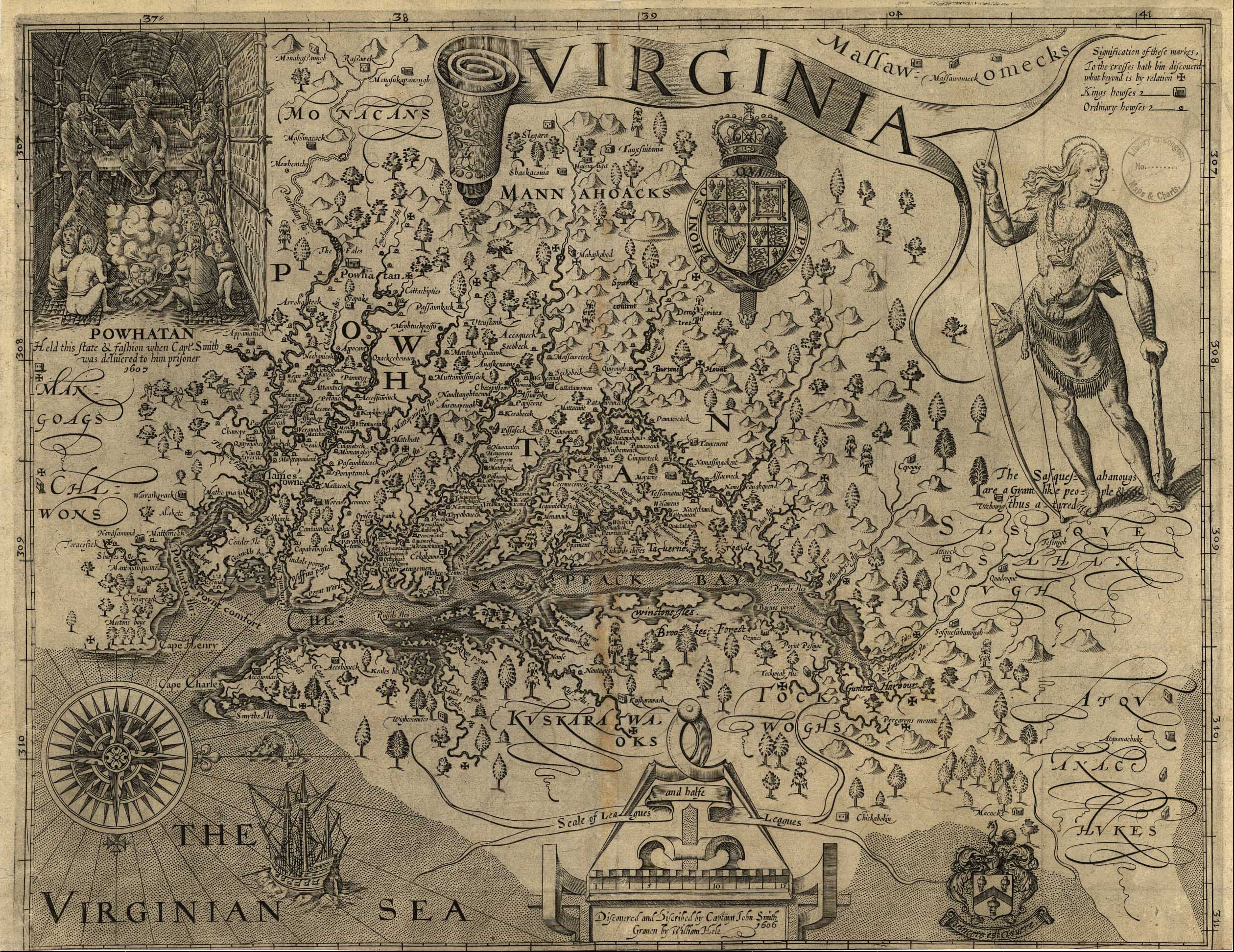
Captain John Smith created the first detailed map of Virginia upon arriving in Jamestown aboard the Susan Constant. Though the date listed on the map is 1606, Smith did not arrive in Virginia until 1607, and the map wasn’t published until several years later in England.
Note that though most maps today have North at the top, Smith’s map is oriented with North on the right side as sailors often drew maps based on how they were viewing or approaching the land.
What do you see on this map that’s familiar or different today? Can you find where Henricus was established in 1611? (Hint: You may want to visit the History of Henricus on our website for a clue!)
To zoom: right click the image and select ‘open image in new tab.’